Te Hikoi Hitori o Paekākāriki
Short History Trail
By Julie Warren
Paekākāriki is the home of Ngāti Haumia, a railway town, a stop on the old coach road, a camp for 15,000 US Marines. Today some of this history is still standing and others are recorded in the Paekākāriki History Walk.
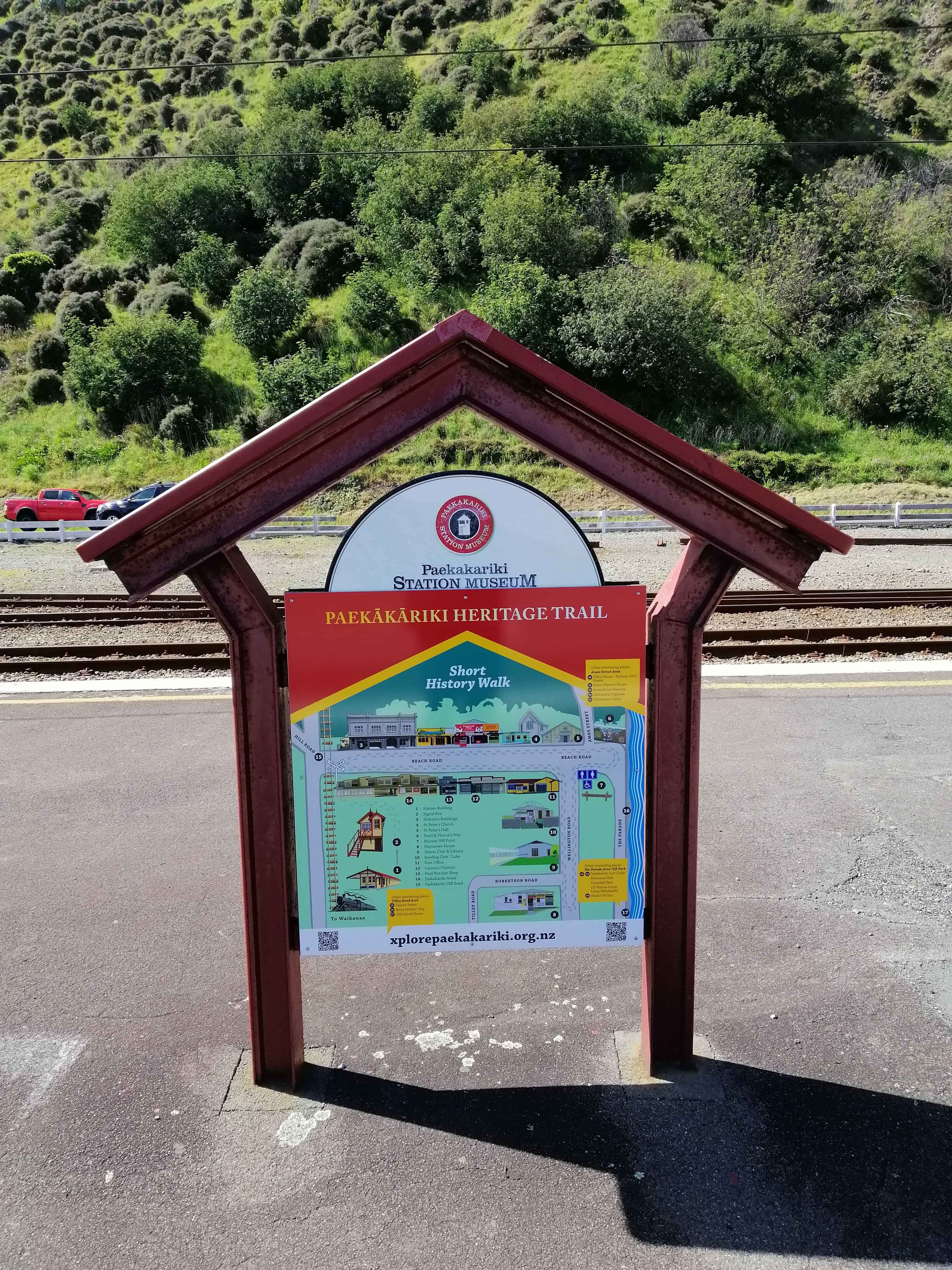
If you arrive by train then you can begin the walk at the Paekākāriki Railway Station which is #1 on the map. If you visit on weekends then the Station Museum is open from 11 am to 3 pm and is well worth a visit.
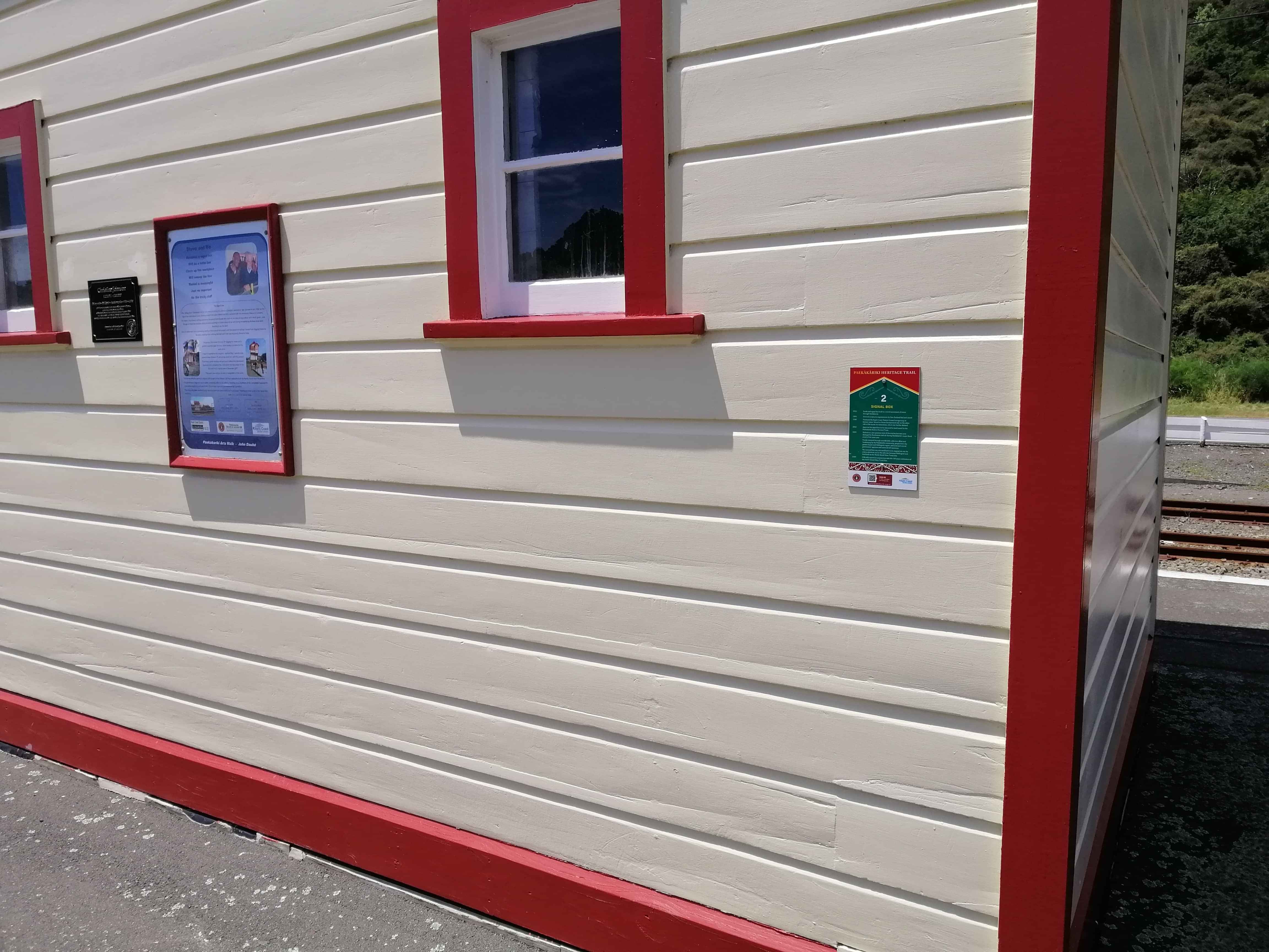
Signal Box
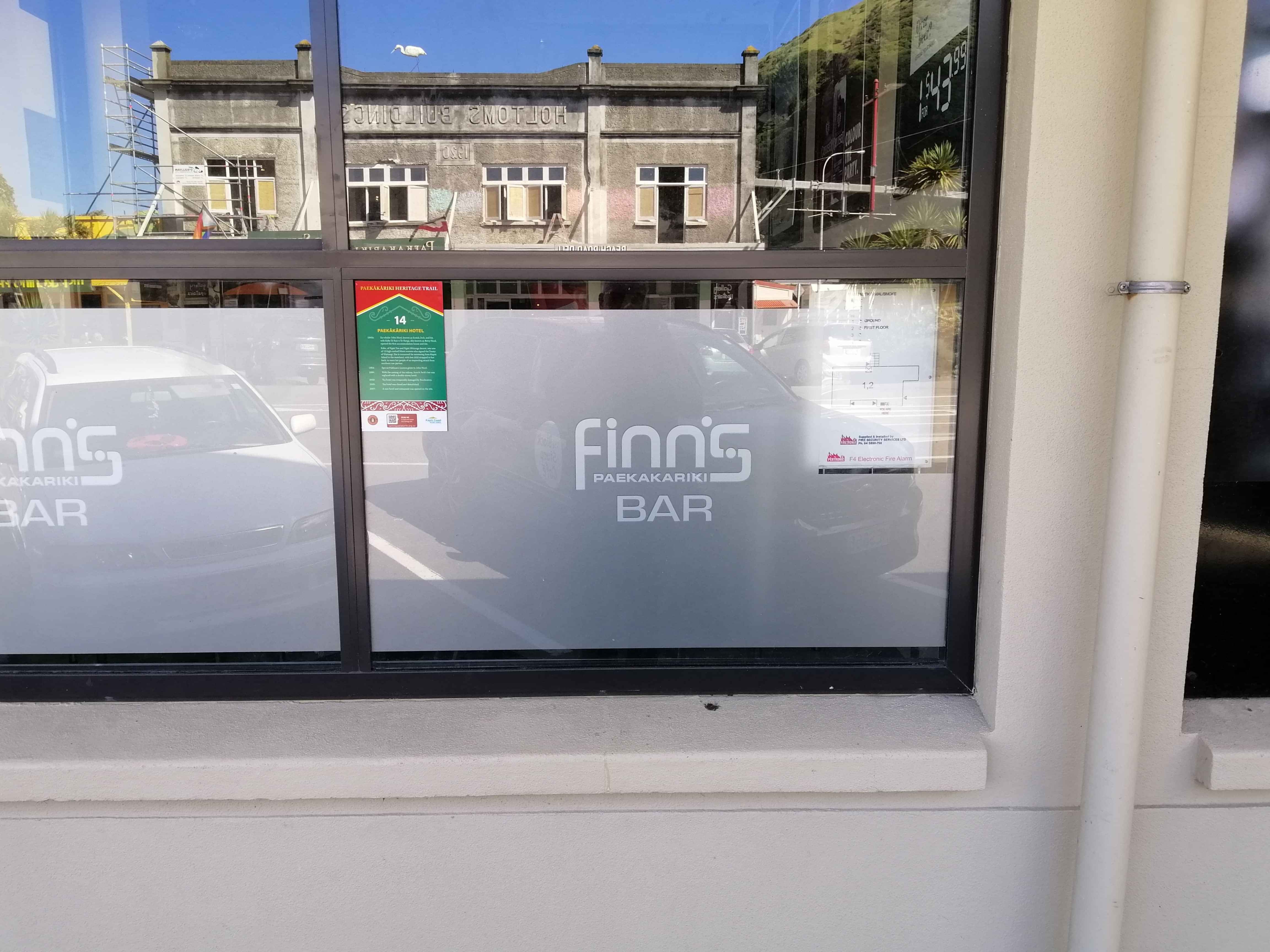
Finns Hotel - Beaach Road
The walk is a short distance around the village streets and takes you from the Railway Station through the village to the beach, back up a small hill and along Wellington Road then back to the village.
Who It Suits
The walk is very easy with a small rise at the end of Beach Road towards the beach.
How Long It Takes
It should take you around 20mins to complete the walk depending on the amount of time you stop and read the various plaques. If you start at the station and finish back at the village then the walk is approx. 1 km in length.
Highlights
There are 14 signs attached to various building or places of interest
#1 Station Building
#2 Signal Box
#3 Holtom’s Building
#4 St Peter’s Church
#5 St Peter’s Hall
#6 Pearl & Florrie Walkway
#7 Murray Hill Point
#8 Playcentre House
#9 Tennis Club & Library
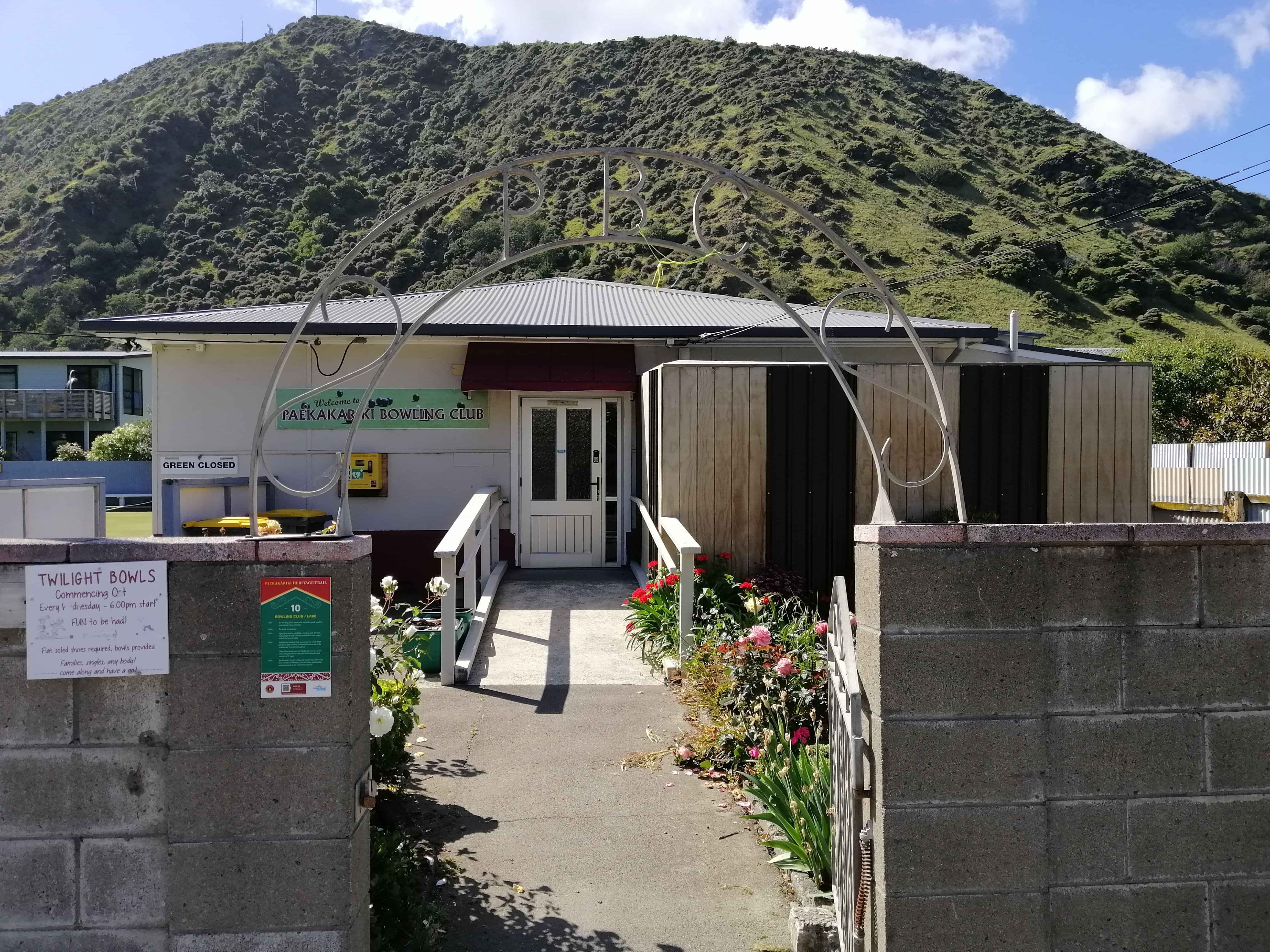
#10 Bowling Club / Lake
#11 Post Office
#12 Carson’s Chemist
#13 First Butcher’s Shop
#14 Paekākāriki Hotel
Each plaque has a unique QR Code that when scanned will take you to a webpage giving more details about that particular site.
Directions
If you arrive by train then the walk begins at the Railway Station built in 1909. Walk south along the platform towards the village. You will pass the signal box (Number 2 on the map), which was restored through community effort and relocated to its original site at the south end of the platform. The original signal box from the north end of the platform has been restored and relocated to Ohakune.
Cross the road to the Holtom’s Building and shops (# 3 on the map). The general store dates back to the early 1900s. The Holtom’s Building was built in 1920. The plaque tells you some of its history. There used to be a crushing plant nearby, on the other side of the railway line, before the highway was built. Shells were crushed for construction use.
If you arrive by car then starting at #3 Holtom’s Building would be a good place to begin.
Next, walk along Beach Road towards the sea, on the same side of the road as Holtom’s, until you get to St Peter’s Church (# 4 on the map) and, next door, St Peter’s Village Hall (Number 5).
Cross Ames Street and head further along Beach Road towards the sea and the beginning of The Parade. Pearl and Florrie’s Way (# 6) will take you down to the sea. If you cross over the road at this point you will arrive at Murray Hill Point (# 7). You might like to sit on one of the seats and enjoy the view.
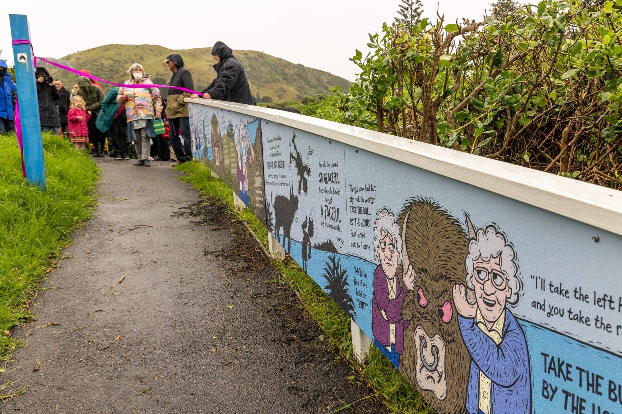
Pearl & Florrie's Way to Beach
Photo By Bob Zuur
Paekakariki Bowling Club
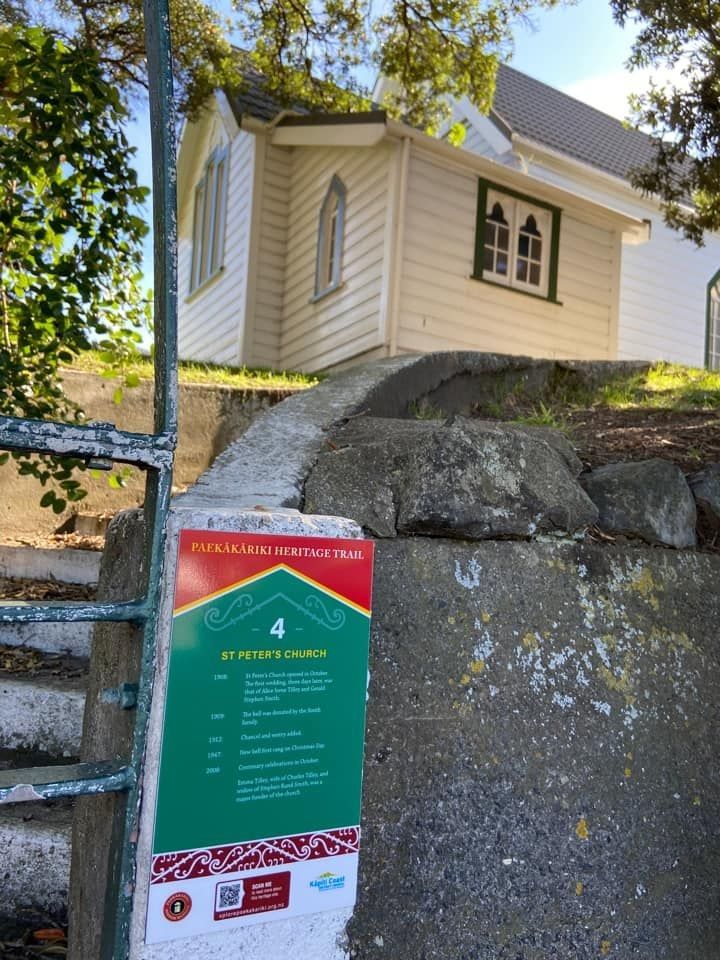
St Peter's Church - Beach Road
Walk along Beach Road towards the village, then down Wellington Road heading North. At the intersection with Robertson Road you will find the Playcentre House (#8) on one corner and the Tennis Club / Library (#9) on the other. Next to the Tennis Club is the Bowling Club (# 10). This is located on what used to be a small lake and surrounding wetland before it was drained for development. The lake used to be a popular boating area. At one stage, the area behind the current club was used to feed and water Cobb & Co horses.
Return along Wellington Road to the site of Paekākāriki’s last Post Office on the corner of Wellington Road and Beach Road (# 11 on the map). Earlier Post Offices were located in the hotel and the railway station before moving to a purpose-built building close to the hotel around about 1905 and its final building and residence in the 1920s.
As you head back on Beach Road you will pass the sites of Carson’s Chemist (#12 on the map) and one of Paekākāriki’s earliest butchers (# 13 on the map). Next to this is #14 Paekākāriki Hotel.
Finns Restaurant and Bar are located on the old pub site and would be a suitable stopping off place for refreshments along with the several cafes located on the other side of the road.
You may like to extend your walk along The Parade, Ames Street and/or Tilley Road. Points of interest are shown on the map also.
Facilities
Public toilets are conveniently located on the Beach Road / Wellington Road corner.
Food and drink
Likewise, the cafes and pub are right in the village centre, to meet any refreshment needs at either end of the walk.